Case Study
Regional GIS North – interactive tool and service for municipalities using geodata in daily work
Contact name
Patrick Schaack
Institution name
Nature Park Our
Region & country
Luxembourg
Summary
The “Regional GIS North” project was launched in 2005 as part of the European LEADER+ initiative in the Clervaux-Vianden region.
In order to make the data available to the participants, web-based workstations are provided that allow the data to be displayed visually, information to be called up and processing operations to be carried out. Central administration of the digital geodata simplifies handling for the user. In addition, the data are available for regional planning purposes.
The GIS (Geographic Information System) combines local, regional and national data in one database. This provides the member municipalities with an interactive tool that simplifies the day-to-day handling of geodata.
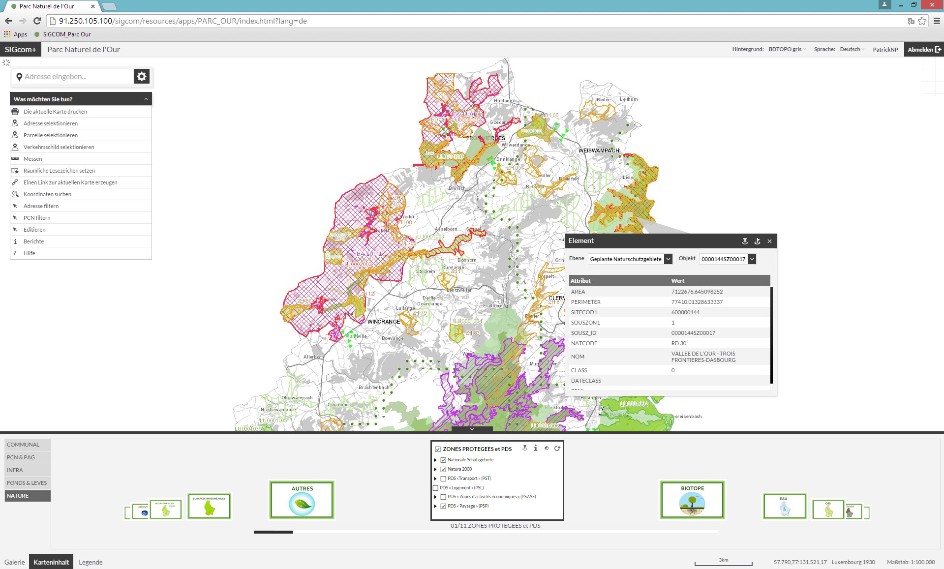
SIGCOM+ Interactive tool for municipalities
Nature Park Our

SIGCOM+ Interactive tool for municipalities
Nature Park Our
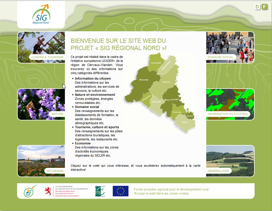
SIGNORD Interactive tool for tourists and inhabitants
Nature Park Our
Background of the project
Before the project was launched, location-based data were available mainly in analogue form, that is, as paper plans. It was thus difficult to compare different data. In addition, there was information that existed only in the employees’ heads and was thus not available to all concerned.
The Park municipalities were aware that analogue archiving of location-based data had no future; they were growing and so were their staffs. A digital version of the data had to be created to ensure that all employees benefit from the same knowledge level. But the technical know-how and financial resources were lacking to implement such projects independently. Several LEADER projects were therefore submitted and implemented under the aegis of the Our Nature Park to set up the regional platform.
Solution and actions taken
A regional platform was created, which is centrally managed and coordinated by the Our Nature Park. In this way, all municipalities can be kept up to date with regard to both the software and the data.
– Development of a web-based, personalized application
– Development of a web-based, publicly-accessible application for the general public
– Annual further training courses for all users
– Regular meetings of a working group
Other institutions or parties involved
– Intermunicipal Syndicate for the promotion of the Canton of Clervaux (S.I.Cler)
– Currently, 9 municipalities (Clervaux, Kiischpelt, Parc Hosingen, Putscheid, Tandel, Troisvierges, Vianden, Weiswampach, Wincrange)
– Working group leader Clervaux-Vianden
Results
The introduction of the regional GIS has changed the daily work routine in the municipal administrations. In this way, information is made available to all employees (with access authorization) at all times. This can also be seen from the number of times the application has been accessed.
Challenges
Digitization and collection of the required data were the biggest challenge, along with the selection of suitable software (and also getting all project participants to agree on a solution).
Lessons learned
Central management of the regional GIS has proved its worth to date. The expertise available in the Our Nature Park enables the municipalities to concentrate on their daily work without having to worry about the technology in the background.
Contact name
Patrick Schaack
Institution name
Nature Park Our